
The most complete guide on the Caminito del Rey in Malaga. I’ll tell you how to get to the Caminito del Rey, the schedule, the price of the tickets, the accesses, the history of the Caminito del Rey, how long it takes to do it, the difficulty of the route, even other options nearby hikers in case you want to complete your visit.
Everything you need to know to enjoy the Caminito del Rey, the most important attraction in the province of Malaga and an essential for visits to the city of more than one day.
We recommend you consult and browse the Caminito del Rey table of contents for your convenience.
Brief history of the Caminito del Rey
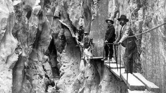
We go back to 1901 when the Chorro Hydroelectric Society saw the need to have an access to facilitate the passage of maintenance workers, transportation of materials and surveillance of the Gaitanejo and Chorro Falls. This is how the first version of a walkway was created that ran along what we now know as “Caminito del Rey”.
The initial road, completed in 1905, began next to the Renfe train tracks and ran through the Gaitanes Gorge, connecting and facilitating passage between both sides.
While the reservoir was under construction, between 1914-1921, numerous people visited the area for the fantastic landscapes that could be seen during the tour and for the construction itself.
Who built the Caminito del Rey?
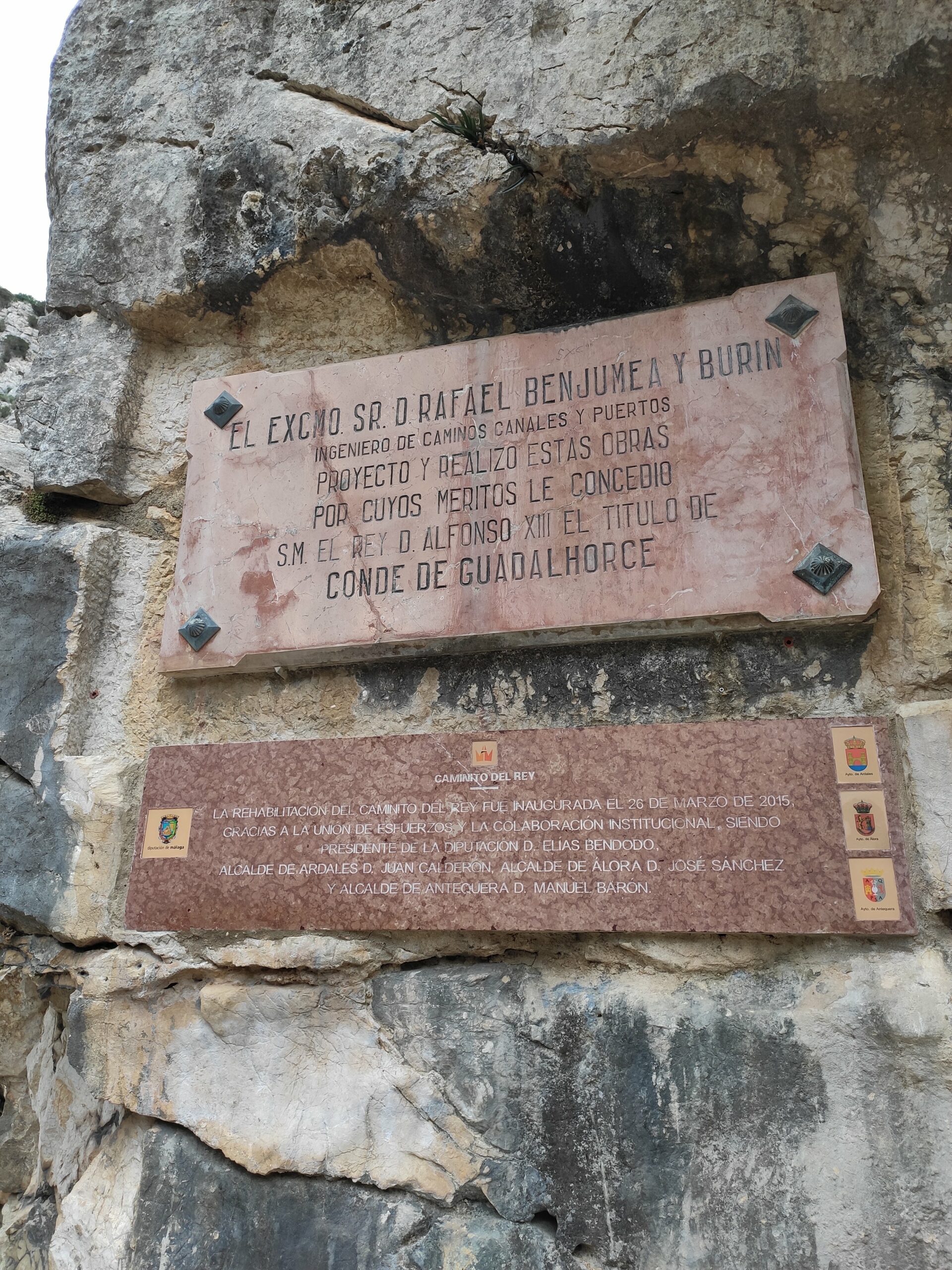
El Caminito del Rey was built by the civil engineer Rafael Benjumea, who later became Minister of Public Works from 1925 to 1930.
Benjumea was in charge of Two other large works in the area: the hydroelectric power station and the Pantano del Chorro, later known as the Conde del Guadalhorce reservoir.
The realization of all these works in the Chorro area earned Benjumea the title of count of Guadalhorce, which was given to him by Alfonso XIII on September 12, 1921.
Why is it called the Caminito del Rey?
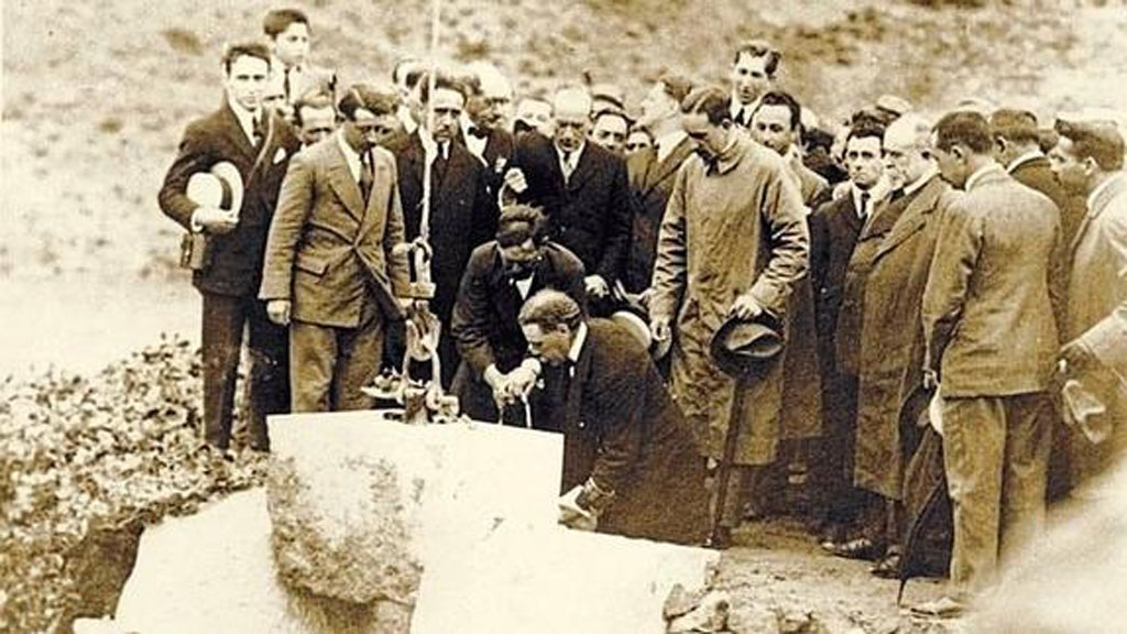
Due to the growing interest in the area, Benjumea changed the old wooden boards, which linked the plant and the reservoir, for a cement walkway and It was decided to reform the bridge between the two sides of the Gaitanes gorge, then calling it the “balconcillo de los gaitanes” and later “Caminito del Rey” after the visit of King Alfonso XIII on May 21st, 1921.
To inaugurate the Guadalhorce-Guadalteba reservoirs, King Alfonso XIII had to walk that path and that is where his name comes from.
Decay of the Path.
Unfortunately, the Caminito del Rey began to fall into disuse and the lack of maintenance left it in a terrible state, without a railing for much of the route and with many parts in ruins.
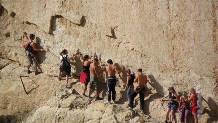
The old Caminito del Rey began to be dangerous (unlike the great security that the current one presents).
In the 90s it became very popular for climbers and adventurous hikers, however some fatal accidents caused it to be closed to the public in 2001 and fines of up to €6000 were even decreed for passing through it or being around.
The new Caminito del Rey.
In 2009 the project went out to tender, with the collaboration of the Provincial Council of Malaga and the Junta de Andalucía. In 2014, the refurbishment works began, which lasted for a year.
El Caminito del Rey, as we know it today, opened to the public on March 28th, 2015.
The first 5 things you should know about the Caminito del Rey.
In this guide you will find all the necessary information, in detail, to plan your visit, but I wanted to highlight 5 points that are essential on the Caminito del Rey.
How far is the Caminito del Rey?
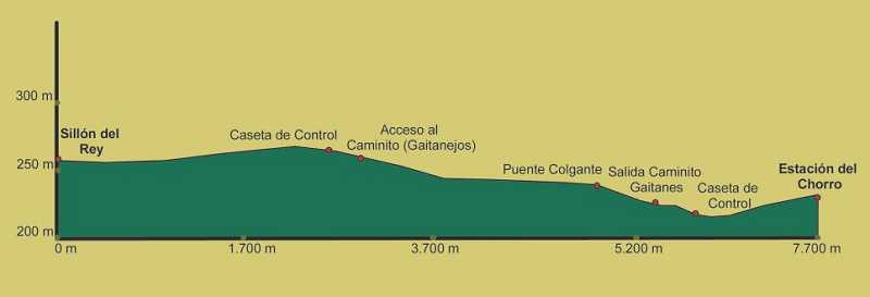
El Caminito del Rey is 7.7 kilometers long , being the part of walkways (the most beautiful and well-known) of 2.9 km , controlled by an access that requires input.
- The rest of the Caminito del Rey is freely accessible and largely coincides with the Gaitanejo path.
How do you walk the Caminito del Rey?
The route of the Caminito del Rey can only be done on foot and is linear, that is, in one direction, always in the same direction and ONLY HAS ONE POINT OF ENTRANCE, by the so-called north access, near Ardales and has its exit in the south access, El Chorro area.
- To return to the beginning, at the end of the route (south access) there are shuttle buses that I will tell you about later.
How long does it take to walk the Caminito del Rey?
The excursion to Caminito del Rey requires advance ticket reservation and it takes about 4 hours to complete it, so calculate your time well (you should arrive at the north access 1 hour before the time indicated in your ticket).
How difficult is the Caminito del Rey?
The tour is suitable for all audiences (children from 8 years old), although a minimum physical condition is recommended .
I also recommend you go with comfortable clothes and appropriate footwear to a trail and dirt track (the first part).
Hydration is key, especially in summer, because it is a long excursion, so bring water or other liquids. And don’t forget sunscreen and sunglasses.
- If you do it in autumn-winter, bring some warm clothing, because in that area it is always colder than in Malaga Capital.
Bathrooms, cover and security?
- You have bathrooms both at the beginning of the route and at the end of it, where you will not find it will be in the 2.9 kilometers of route between the walkways.
- There is 4G coverage throughout the route, although only Vodafone usually provides coverage and for your safety they will give you a helmet at the beginning of the route.
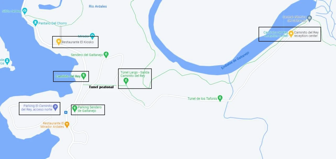
How to get to the Caminito del Rey?
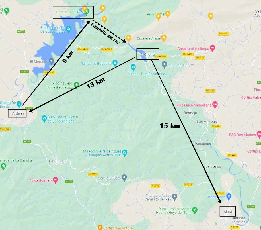
El Caminito del Rey is located in the Desfiladero de los Gaitanes Natural Park, between the municipalities of Ardales, Álora and Antequera, in the province from Malaga, although for practical purposes it is considered to be in Ardales, more specifically in the area called “El Chorro”, due to the reservoir of the same name.
El Caminito del Rey is about 60 kilometers from Malaga capital, which we can travel by car in 55-60 minutes from Malaga capital on the A- 357 and then the MA-5403.
For the near future, the opening of the Visitor Reception Center, located in the Port of the Watchtowers.
The first thing we should know is that the entrance to the Caminito del Rey is unique and must be done by the called north access, being the only option to arrive on foot at the beginning of the route.
- Name: Caminito del Rey Reception Center
- Location on Google Maps.
Where is the entrance to the Caminito del Rey?
To get to the entrance of the Caminito del Rey (Reception Center of the Caminito del Rey) we have two options:
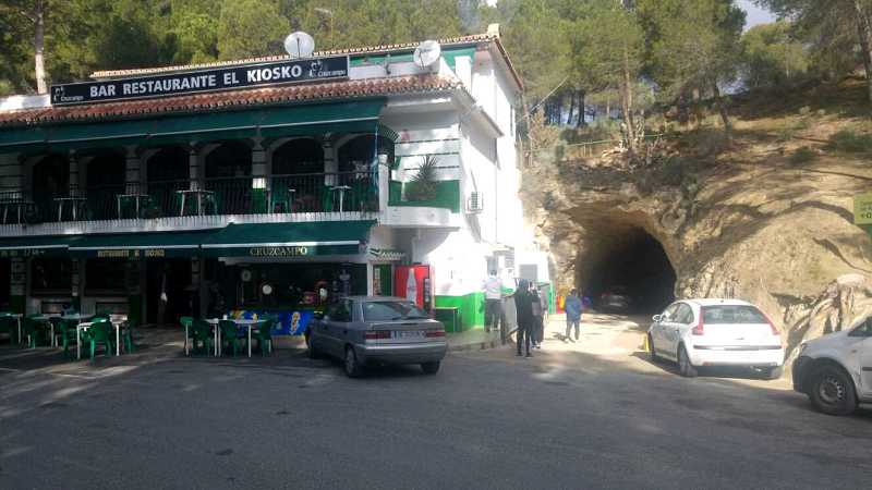
A) Short tunnel and Gaitanejo path
- Distance to entry point: 2.7 km of route.
- Time taken: 35-40 minutes.
- Difficulty: medium-low.
- Location: next to “El Kiosko” Restaurant.
- Google Maps location: https://goo.gl/maps/PDrPbLBZTfqgb7MR9
My advice is to arrive in this area at least 1 hour before your entry, to do it calmly and enjoy the scenery.
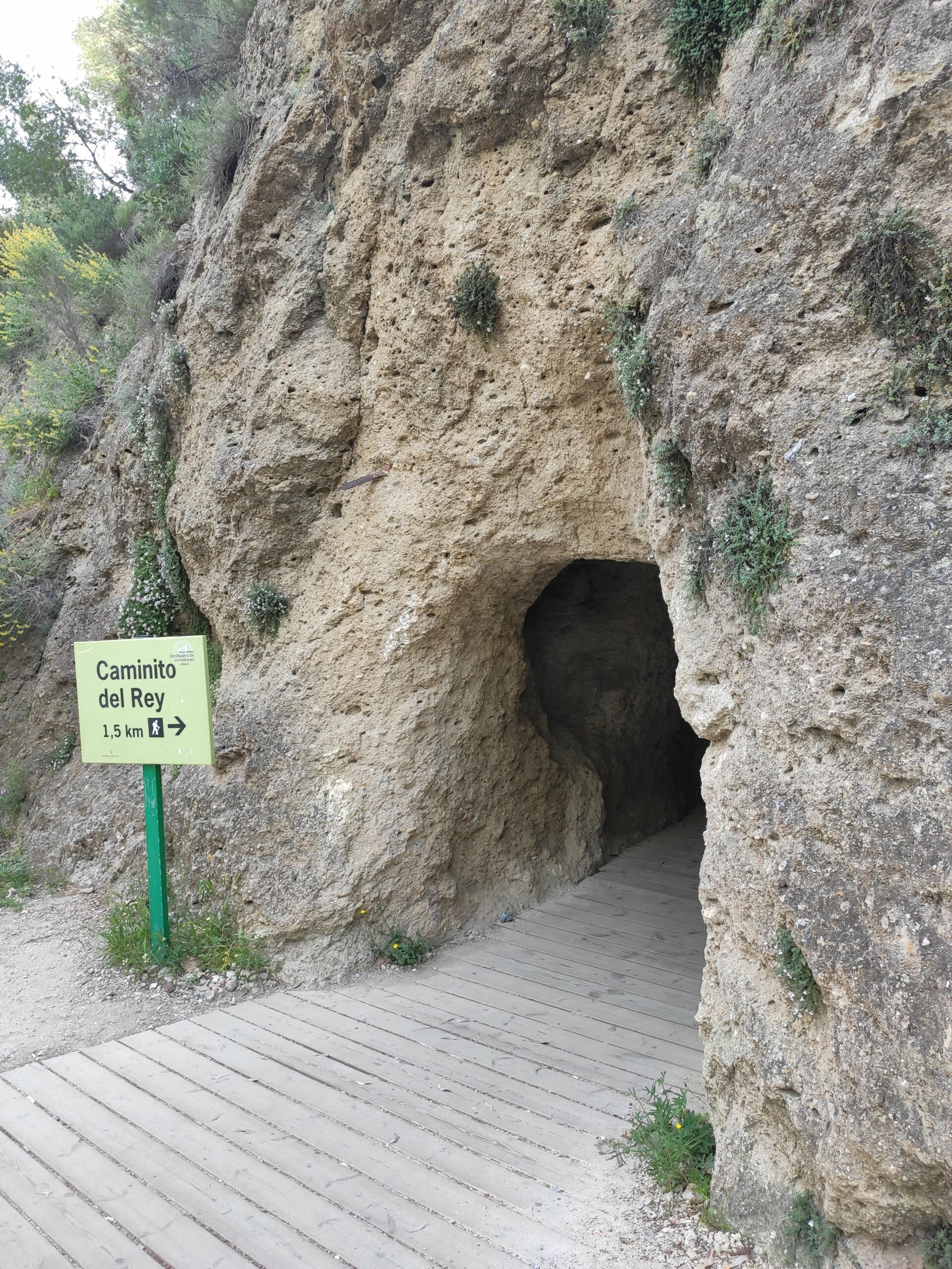
B) Pedestrian tunnel and Gaitanejo track.
- Distance to the entry point: 1.5 km of route.
- Time spent: 25 minutes.
- Difficulty: low.
- Location: between the “el Kiosko” and “el mirador” restaurants.
- Google Maps location: https://goo.gl/maps/7M8KaMmpJyBTpCpb7
You can take both accesses, which you can decide based on the time available, but my advice is to take the pedestrian tunnel option because it is more direct.
Caminito del Rey shuttle bus. South access to north access (entry point)
As we have mentioned there is only one access point (north) to the Caminito del Rey, but to communicate the route there are some shuttle buses that take us from the southern access (end route) to the north access (start of the route) and vice versa.
- Shuttle bus timetable (line M-347 Caminito del Rey – El Chorro- The Kiosk).
- Hours: 9 a.m. to 7 p.m. in summer and 9 a.m. to 6 p.m. in winter.
- Frequency: 30 minutes.
- Price: €1.55 (cash, not cards).
- Journey: 15-20 minutes (stops next to the “el kiosko” restaurant).
How to get to Caminito del Rey from Malaga by car?
Arriving by car is the most common option to go to the Caminito del Rey on your own. For this we must leave about 2 hours before the start of the visit, to be able to make the journey to Ardales, park the car and make our way to the entrance of the Caminito del Rey.
The journey by car follows the A-357 and then the MA-5403 passing through the municipalities of Cártama, Pizarra, Carratraca, and Ardales. It is 60 km and one hour of travel.
Where to park on the Caminito del Rey?
- You have a guarded car park next to the entrance of the pedestrian tunnel, which for 2€ allows you to leave the car all day.
- Other, less safe options are to leave the car on the side of the road, although you must go first thing in the morning, otherwise there will be no room.
- And another alternative would be to leave it at the Sendero del Gaitanejo Parking or in the vicinity of the “El kiosko” restaurant .
- The last option is to park in the south access and take the shuttle bus that takes us from the south access to the north access (entrance point to the Caminito del Rey).
How to get to the Caminito del Rey by train from Malaga?
The closest train stop to the Caminito del Rey is the “El Chorro – Caminito del Rey Station (Álora)” on the Media Distancia line (MD) from Renfe.
A journey from Málaga María Zambrano (Malaga train station) takes 40 minutes.
The problem lies in two aspects, on the one hand the infrequency of this journey and on the other, that we must take the shuttle bus to get to the north access where the entrance point to the Caminito del Rey explained above is.
Train schedules from Malaga to El Chorro.
- 08:58 – 09:37
- 13:21 – 14:02
- 17:19 – 17:59
- One-way price: €6.25
- Price for round-trip purchases: €5
Train schedules from El Chorro to Malaga
- 09:23 – 10:06
- 10:41 – 11:17
- 13:51 – 14:34
- 21:07 – 21:46
- One-way price: €6.25
- Price for round-trip purchases: €5
Another option may be to combine the train journey Málaga – Álora (Cercanías Málaga line C2) with the bus M-340 – Álora-Bermejo-El Chorro/Caminito Del Rey
And lastly, I offer another option which can be sleeping in Ardales or Álora and waking up near the Caminito del Rey to make the most of the day.
Caminito del Rey: schedule, entrances and tickets.
The first thing is to know the types of entrance to the Caminito del Rey and their prices.
El Caminito del Rey entrances.
We have 2 types of tickets for the Caminito del Rey:
- General: €10
- Purchase limit of 10 tickets
- Official guided tour: €18
- Maximum group of 30 people accompanied by a guide with a quality certificate.
- Guided tours in Spanish and English.
Important facts about the tickets.
- Children under 8 years old cannot access the Caminito del Rey.
- The daily quota of tickets to the Caminito del Rey is 1,100 people.
- The entrances to the Caminito del Rey occur in 10-minute intervals, although it is recommended to be at the starting point about 25-30 minutes beforehand.
- No changes or returns are allowed.
- In case of closure of the Caminito del Rey due to bad weather (wind, heavy rain, etc.) the so-called “exchange for closure” can be made, which is a change of date to be made in the personal space of the official website .
Where can I buy tickets to go to the Caminito del Rey?
They can be purchased at the Caminito del Rey official ticket purchase page , however access to the €10 general tickets requires buying them well in advance (4-5 months), so it is usual to find only the €18 guided tour tickets .
To give you an idea of the deadlines, I leave you the opening dates for places in 2022:
- January 18, 2022: entries from January 20 to June 19, 2022.
- April 5, 2022: entries from June 20 to November 6, 2022.
Other providers offer all-inclusive packs and tickets, which can be a solution if you don’t get tickets on the official website or are looking for them to do everything else for you easy.
Caminito del Rey schedule and opening hours.
El Caminito del Rey is open from Tuesday to Sunday all year round, except January 1, December 24-25 and 31.
Caminito del Rey summer timetable
- Dates: April 1 to October 24
- Hours: 10:00 a.m. to 5:00 p.m.
Winter timetable of the Caminito del Rey.
- Dates: October 25 to March 27
- Hours: 9:00 a.m. to 3:30 p.m.
My recommendation is that you visit it first thing in the morning, because there is less influx, or first thing in the afternoon, because you will even have shaded areas produced by the cannon itself.
El Caminito del Rey.
Once all the details about the Caminito del Rey are known, it is time to enjoy the route, also known as the Camino del Rey de Málaga.
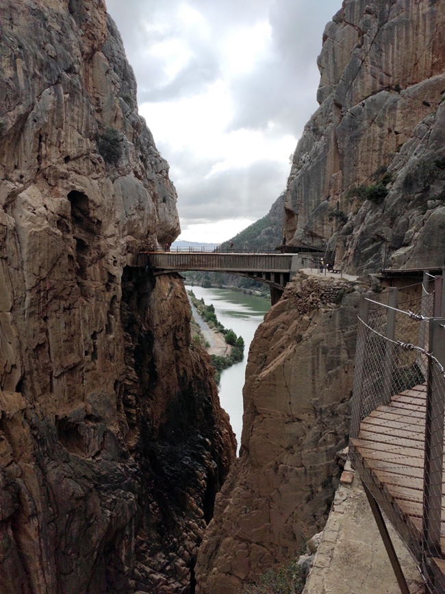
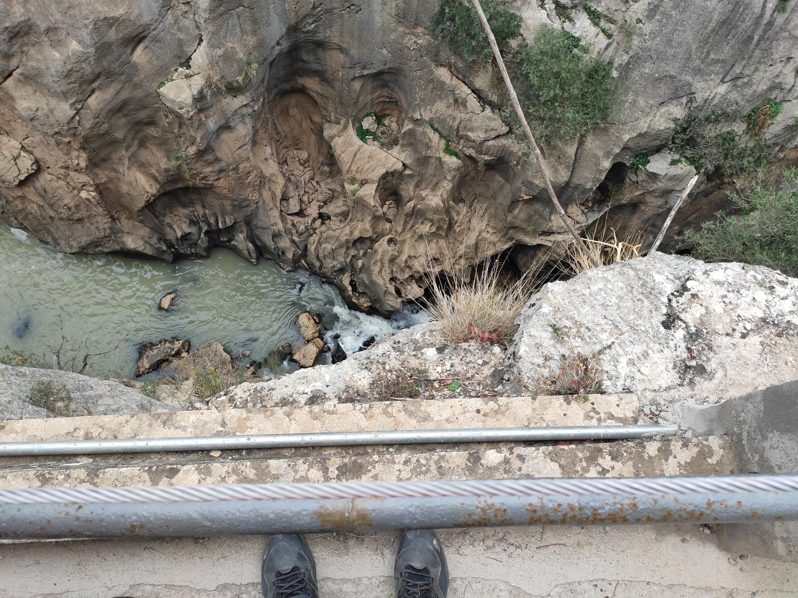
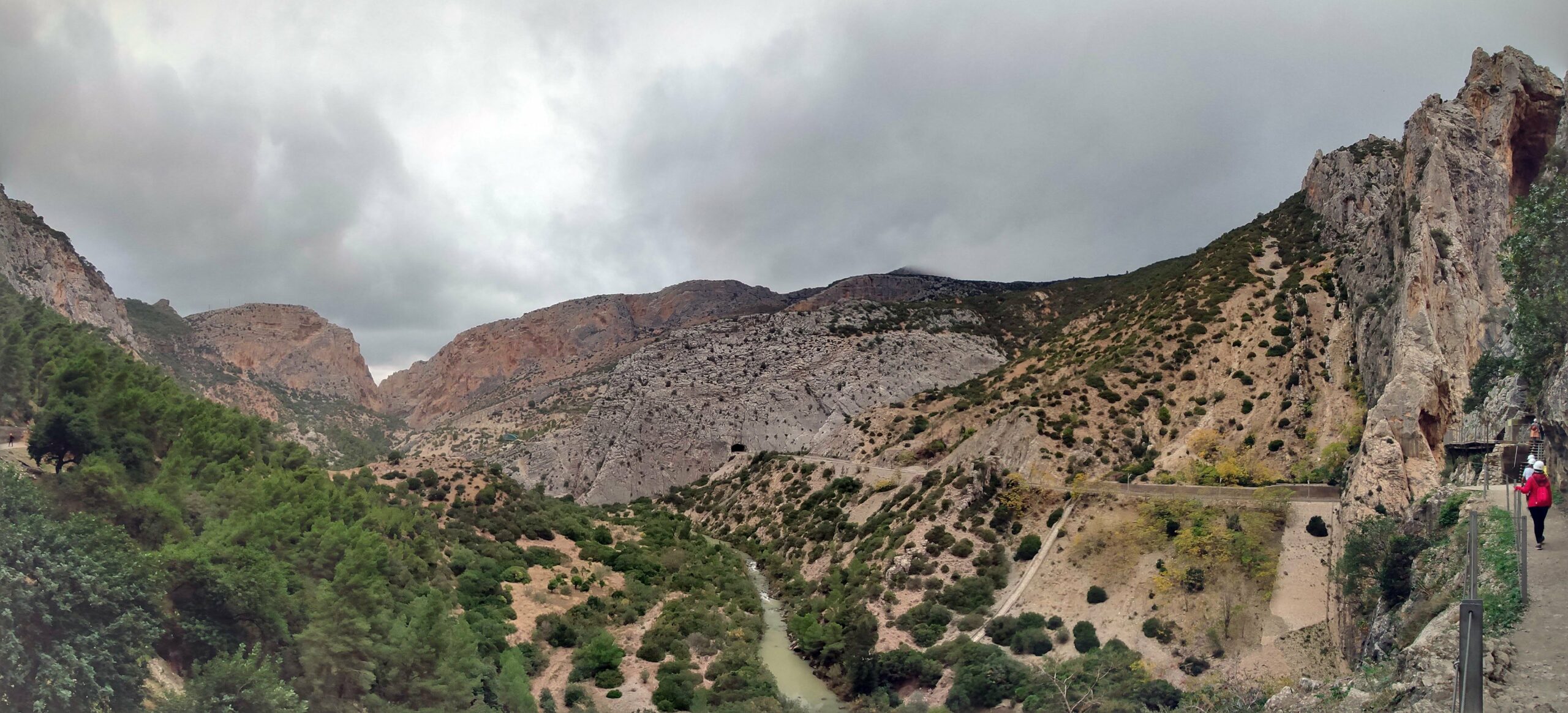
The part of the Caminito del Rey that requires an entrance is 2.9 km long and runs along footbridges (wooden) attached to the rock inside a canyon, with sections barely a meter wide, hanging up to 105 meters above the river, on walls that are vertical.
We are facing a unique natural environment, which runs between two gorges, canyons and a large valley, partly by paths and partly by footbridges.
As we have commented, the Caminito del Rey only has one entrance access, so once there we will be at the visitor reception booth, where after showing our entrance, they will give us a protective helmet, footwear and unauthorized items will be checked (umbrellas, walking sticks, hiking, selfie sticks…) organizing the groups according to the planned schedule.
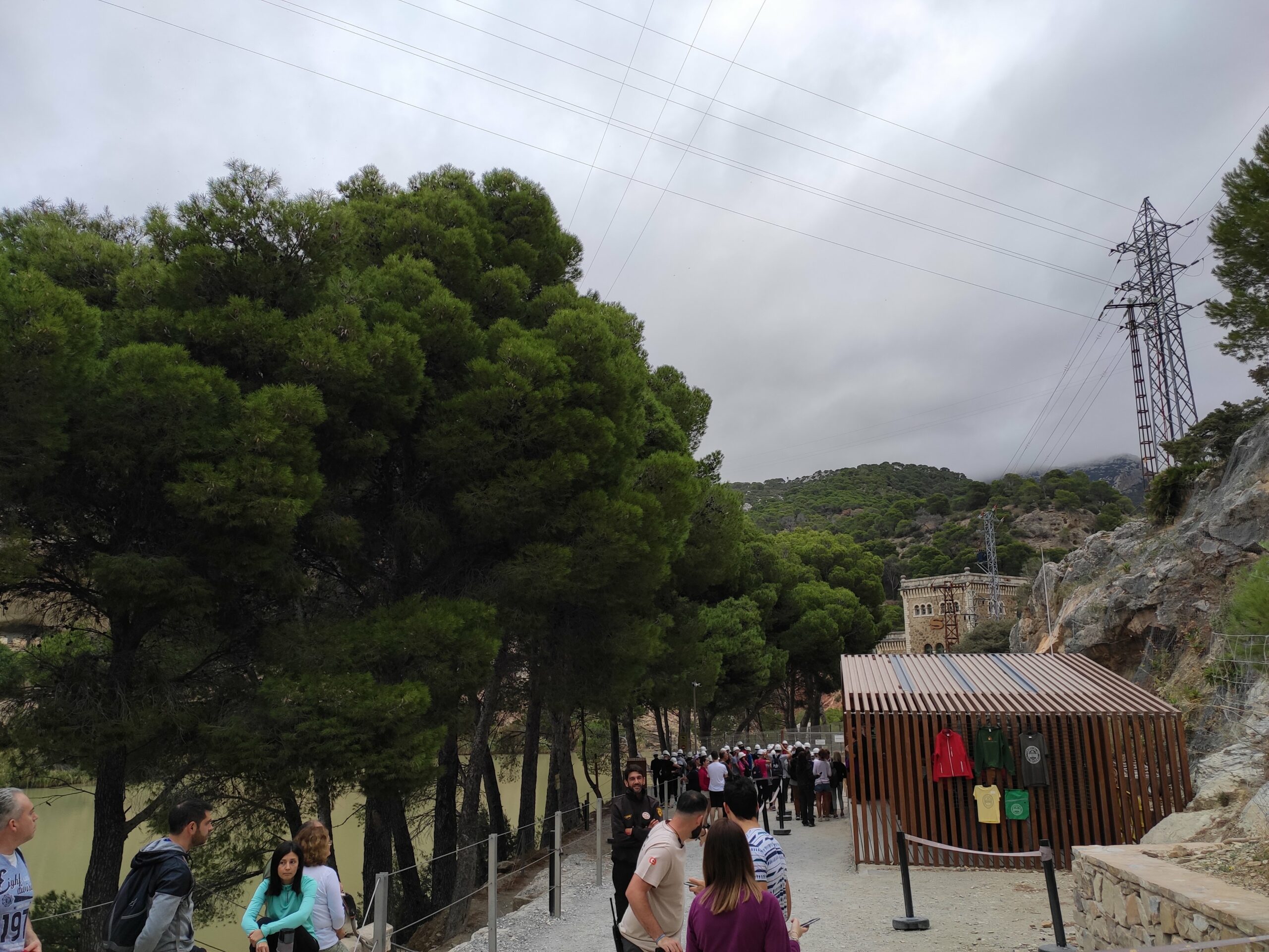
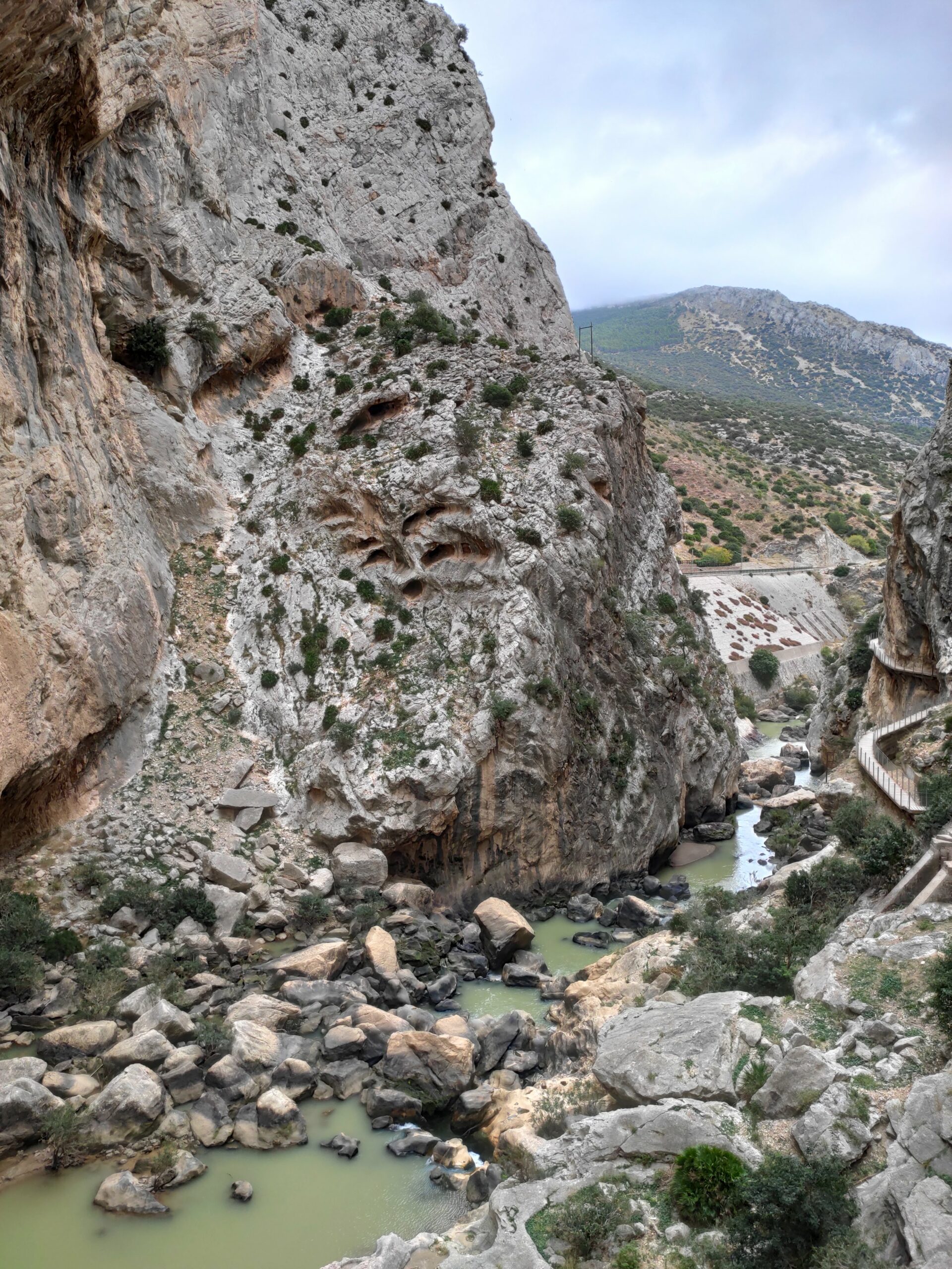
The first thing we see is the Gaitanejo Hydroelectric Power Plant, one of the oldest in Spain, and where we still see a large “S” on the facade reference to the Sevillana de Electricidad company, former owner.
Gaitanejo Gorge and Tajo de las Palomas.
We go a short way along a dirt track and arrive at the entrance turnstile, which gives us access to the gorge barely 10 meters wide.
A little further on we arrive at the place of the grove, which is located between the Gaitanejo gorge and the second canyon on the route, the Tajo de las Palomas
We advance until we reach the valley of the hole, a large natural space with lush vegetation. We have already traveled almost 1 kilometer and we will find a rest area and some information panels.
Photos of the Caminito del Rey.
Gaitanes Gorge.
We now face the second part of the Caminito del Rey, by walkways located more than 100 meters high. We are facing one of the most impressive areas of the path, there are even remains of the old Caminito del Rey, very deteriorated after more than a century of life.
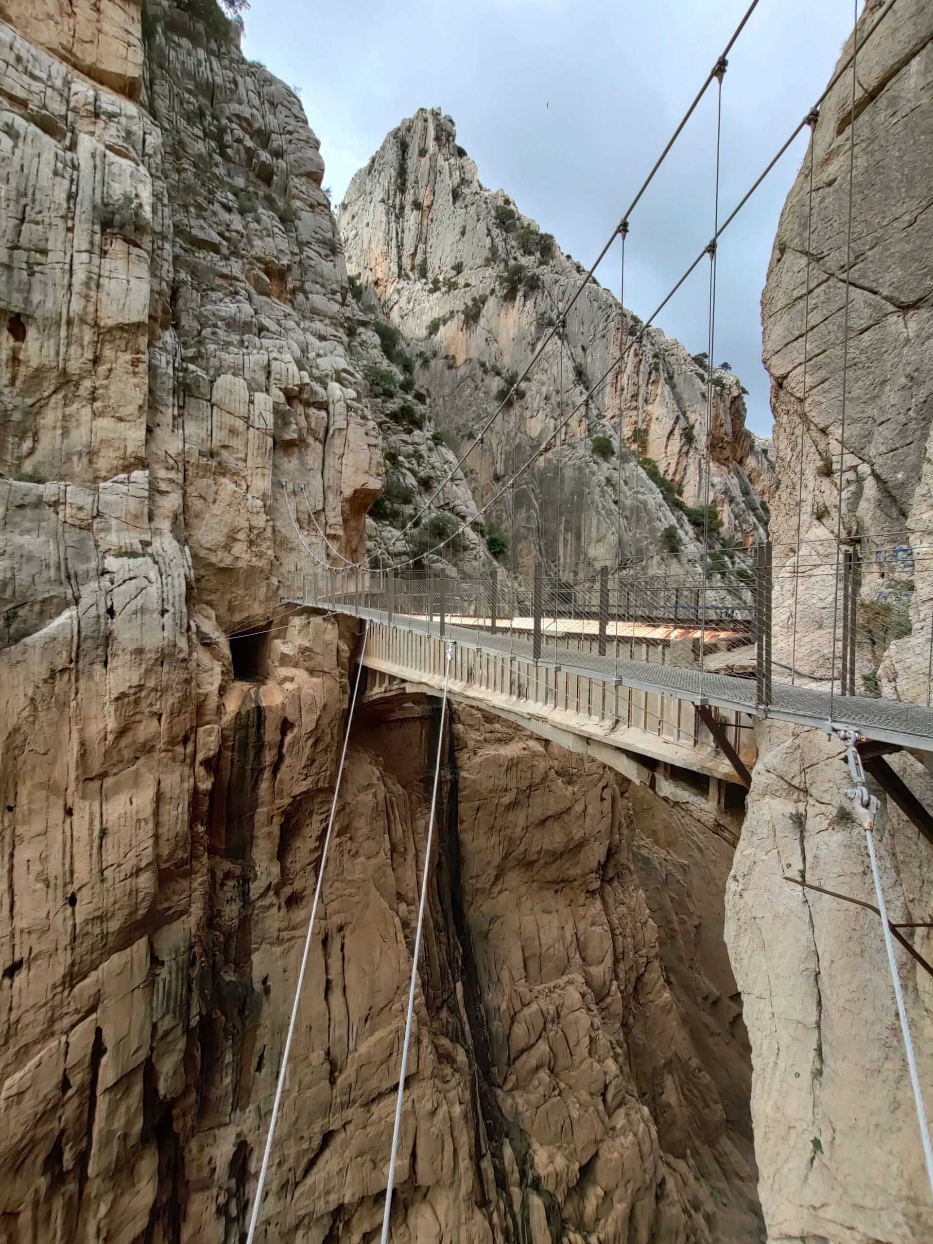
And we arrive at the most photographed place of the tour: the suspension bridge.
It is a bridge anchored with long stays at a height of 105 m, from wall to wall, and 35 m long, which conveys a great feeling of emptiness when looking down… so refrain if you have vertigo or fear of heights.
Exit trail to El Chorro.
After passed the suspension bridge we have to continue walking a small section of ascent with steps to then descend to a landing and we continue walking until completing the 2.1 km of descent to El Chorro, southern access to the Caminito del Rey.
Once in El Chorro, depending on how we have reached the Caminito del Rey we must take the shuttle bus to the north access (where we will have parked), the train to Malaga or the bus to Álora.
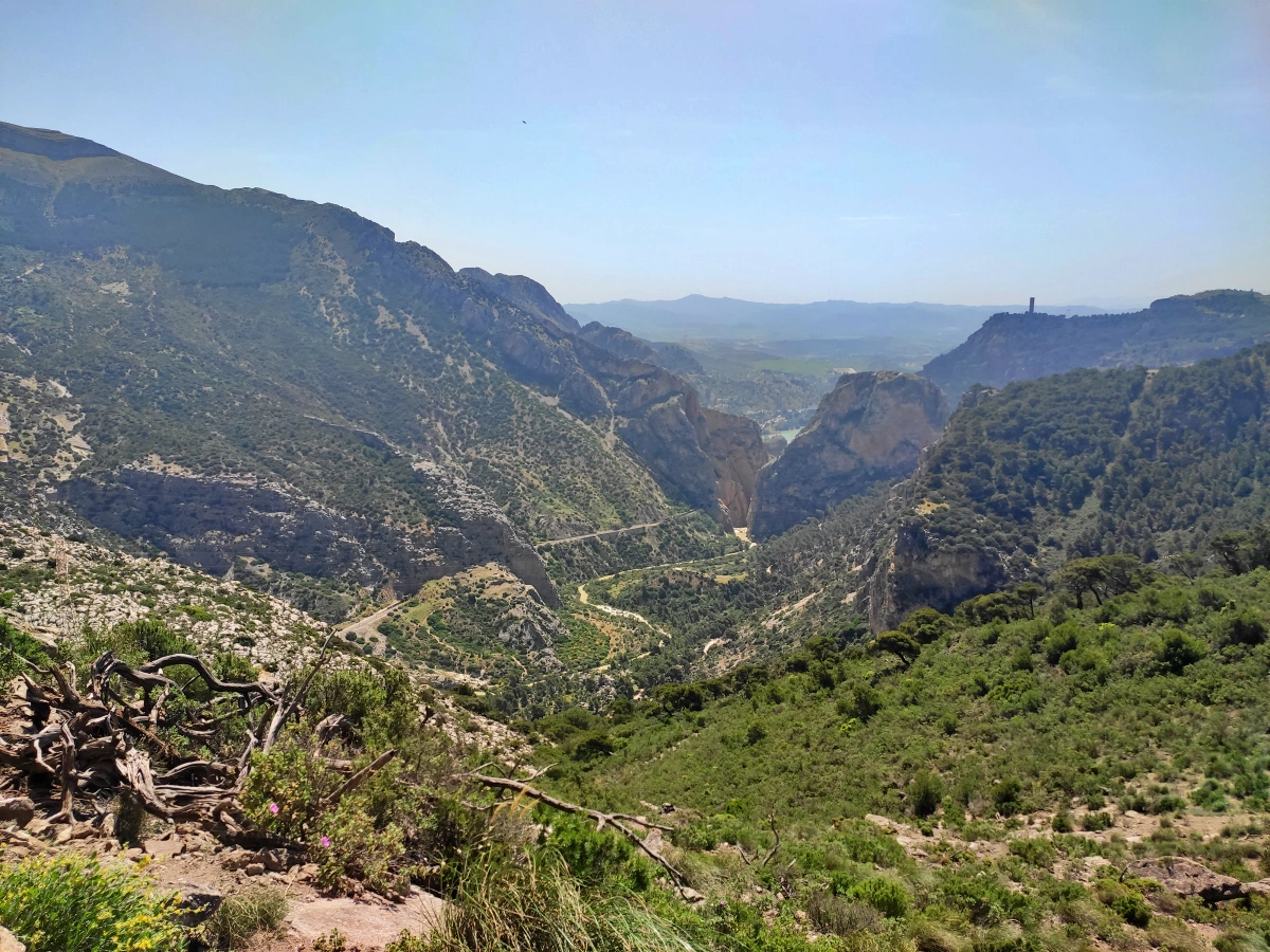
End to my guide on the Caminito del Rey in Malaga, if you are in the Chorro-Ardales area and still want to do more activities, I recommend the climb to Pico del Convento, 670 meters high, that offers spectacular views of the area.
Te puede interesar:

Holy Week in Malaga 2026: Dates, Processions, Routes…
GUIDE to MALAGA FAIR 2024
Christmas in Málaga 2025: Lights, Nativity Scenes…
MALAGA CHRISTMAS Lights 2023: DATES and SCHEDULES
Christmas Lights in Málaga 2025 | Complete Guide,…
Christmas in Torremolinos 2025: Lighting Ceremony,…
Bus Malaga to Torremolinos (M-110): Schedules and Prices
Bus Malaga to Fuengirola(M-113): Schedules and Prices


: Schedules and Prices")
: Schedules and Prices")
- Top 5 Best Flamenco Shows in Malaga - 1 June, 2023
- Christmas in Malaga 2022. What to do and see - 2 December, 2022
- Top 10 Restaurants in Malaga to eat recommended by a local - 18 November, 2022